Bus rapid transit in New Jersey comprises limited-stop bus service, exclusive bus lanes (XBL) and bus bypass shoulders (BBS). Under the banner Next Generation Bus[1][2] New Jersey Transit (NJT), the New Jersey Department of Transportation (NJDOT), and the metropolitan planning organizations of New Jersey (MPO) which recommend and authorize transportation projects are undertaking the creation of several additional bus rapid transit systems (BRT) in the state.
In 2011, NJT announced that it would equip its entire bus fleet with devices for real-time locating, thus creating the basis for "next bus" scheduling information at bus shelters. The introduction and expanded use of bus rapid transit in the Garden State is part of the worldwide phenomenon to bring mass transit to heavily trafficked corridors in both high and medium density areas as a cost-saving, and sometimes more flexible, alternative to rail transportation, thus reducing automobile dependency and traffic congestion.

Context[edit]
Bus rapid transit[edit]
The Federal Transit Administration (FTA) defines bus rapid transit (BRT) is a “rapid mode of transportation that can combine the quality of rail transit and the flexibility of buses.”[3] BRT systems can be designed for specific locations and conditions to incorporate any number of features to enhance bus priority traffic circulation and passenger convenience and can operate on exclusive bus lanes or shared roadways and can combine both limited-stops and skip-stops. Characteristics can include bus stops with kiosks for passengers to easily and quickly pre-purchase bus tickets to reduce boarding time, digitalized countdown timetables for real-time bus arrivals and bus information at the bus shelter and via internet websites. Roadways can have signal synchronization, queue jumping, changeable message signs and pavement striping included. Specific BRT branding (wrapping) and specialized vehicles for faster boarding and alighting can be used.[3][4][5][6]
Bus service in New Jersey[edit]
New Jersey is the most densely populated state in the United States. In the early part of the 20th century, it was served by an extensive system of interurban and streetcar systems, which were replaced during the era of bustitution in the mid century, partially due to the phenomenon known as the Great American streetcar scandal.[7][8] New Jersey Transit, created in the 1970s to take over Conrail commuter rail service, assumed control of several floundering bus companies in the 1980s, including the largest, Transport of New Jersey. The government agency has subsequently grown to be third largest provider of commuter rail, light-rail, and bus service in the nation.[9] Additionally, numerous privately operated bus companies also provide regional and local service within the state and to New York and Pennsylvania. The Northeast Corridor runs diagonally across New Jersey between New York City and Philadelphia, cities to which many residents regularly travel. Additionally, commuters of Rockland and Orange counties, west of the Hudson River above the New York state line, and exurban towns in the Lehigh Valley and Pike County, Pennsylvania travel to or through the state.
Real-time bus fleet[edit]
Real-time locating is a vehicle tracking or fleet tracking system using Global Positioning System (GPS) technology. NJ Transit (NJT) is expanding real-time service information for bus customers to all routes in the state using what has been dubbed "smart bus" technology that can provide real-time bus location and arrival information to web-enabled devices and to “next bus” signage at key locations. In February 2011, NJT authorized a $22 million contract with Clever Devices LTD to install devices on 1,040 buses serving NJT-operated routes.[10] In November 2011, it authorized another $6 million for Clever Devices to equip NJT contracted bus routes with the devices. Completion of the installation is projected for 2013. More than 1,100 new buses coming on line during the period are pre-equipped, thus making the entire fleet "real-time" capable.[11] Real-time customer use was begun with a pilot involving the Trenton and Princeton areas on routes numbered 600 in December 2012.[12] The "MyBus Now" service allows those with smart phones and computers to access NJT's website to see in-transit buses and expected arrival times for those buses within 30 minutes of a bus stop. Commuters can also text MyBus (69287) with the stop and route number to get the arrival time of the next bus. The service was expanded in 2013 to more than 150 NJT routes for Atlantic City, Camden, Philadelphia, and intrastate routes in North Jersey. It will be expanded to buses traveling to the Port Authority Bus Terminal and the George Washington Bridge Bus Station in early 2014.[13][14]
Fare payment[edit]
NJT sells monthly passes, 10-trip discount tickets and single-fare tickets, which are accepted on most private and contracted buses as well as its own. Cash payment, with many routes being exact-fare lines, is also possible.[15] except for departures from the Port Authority Bus Terminal, where since 2011 tickets or passes are required.[16][17]
In October 2011, NJT began a pilot project and become the first transportation agency in the USA enabling passengers to use Google Wallet, a contactless payment system, initially available at ticket vending machines at Port Authority Bus Terminal, New York Penn Station, Newark Liberty Airport Station and on certain Hudson County bus routes.[18][19]
In April 2015 NJT announced that using mobile phone apps to purchase tickets and passes system-wide would be completed.[20]
SmartLink is a smart card used by the Port Authority Trans Hudson, the rapid transit rail system linking Newark, Jersey City, Hoboken, and Manhattan. The Port Authority of New York and New Jersey, which operates the system introduced the card in 2007, as the initial step in creating a universal fare card for the New York metropolitan area. In 2006, estimates for New Jersey Transit to implement use of the card were $100 million.[21]
BRT initiatives[edit]
NJ has various policies to promote its smart growth strategy, intended to reduce urban sprawl and preserve open space, to reduce traffic congestion and travel times though decreased automobile dependency, to promote intrastate public transportation use, and to revitalize older urban and suburban areas through transit-oriented development.[22][23] In 2009, NJDOT adopted a complete streets policy with one of its stated aims to make access to bus stops easier and safer.[24]
The areas targeted for BRT systems are commercial/commuter corridors or high density population or employment centers with a regional transit hub. Some are included in the state's Urban Transit Hub Tax Credit scheme which offers tax relief for developers and employers who relocate or build within walking distance from them.[25][26] Others have been designated transit villages, meant to promote higher density, pedestrian/public transportation oriented development.[27] In some areas traditional rural and suburban land-use have given way to corporate complexes and shopping malls.[28]
While there are express bus routes and some dedicated bus lanes within the state, the only specifically designed BRT system, the go bus, runs through Newark, the state's largest city, to Newark Liberty International Airport and adjacent communities. Elsewhere exclusive bus lanes (XBL) and bus bypass shoulders (BBS) provide for bus priority traffic patterning. Other proposed BRT and BBS projects are in various stages of study and implementation. While some new systems are geared to improved access to Midtown Manhattan and Center City, Philadelphia most are oriented to developing a comprehensive network of intrastate travel.[1][29][30][31]
Existing systems[edit]
Greater Newark[edit]

Newark is the largest city in NJ and lies at the heart of the Gateway Region and the Liberty Corridor, the extensive network of road, rail, shipping, and air transportation infrastructure radiating from Newark Liberty International Airport and Port Newark-Elizabeth Marine Terminal.[32][33] In terms of number of buses in use and passengers served, the Greater Newark bus network is the 20th largest in the United States.[34]
go bus[edit]


NJT began service on the first BRT line, go bus 25, in 2008.[35][36] During peak periods, the line makes limited stops at eleven points between Newark Penn Station and Irvington, running for most of its length along the busy Springfield Avenue transit corridor.[37]
The second BRT line is part of the planned Liberty Corridor Bus Rapid Transit Service network.[38] Funded by the American Recovery and Reinvestment Act, the enhanced bus service was initiated in 2009. The $2 million project includes new bus shelters, signaling priority, and express-limited stop service.[39][40] The go bus 28 is a full-time service between the airport's North Area Transit Center, its three terminals, the city's central business or campus districts, Branch Brook Park, the Roseville neighborhood, and Bloomfield. Connections to Montclair-Boonton Line and Newark Light Rail (NLR) are possible on the line's northern segment.[41] There are proposals to extend the service westward to Montclair University.[34]
| go25 peak service Archived March 14, 2012, at the Wayback Machine | via | |
| Newark Penn Station | Four Corners Essex County Courthouse Springfield Avenue |
Irvington Bus Terminal |
Penn Station-Raymond Boulevard XBL[edit]
A XBL in the vicinity of Newark Penn Station, origination point for numerous Greater Newark bus routes, was conceived in 2007 to improve traffic circulation and pedestrian safety[42][43] and has been in place since 2008.[44][45] The 1,000-foot (300 m) dedicated center bus lane is implemented in the PM rush hour to serve westbound buses along Raymond Boulevard between the station and McCarter Highway. The system includes traffic signal synchronization, changeable message signs and pavement striping.[46]
Lincoln Tunnel express bus lane[edit]
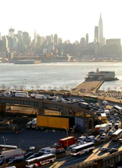

The Lincoln Tunnel Approach and Helix (Route 495) in Hudson County passes through a cut and descends the Hudson Palisades to the Lincoln Tunnel at the other end of which is the Port Authority Bus Terminal (PABT).[47] Starting in 1964, studies were conducted to address the feasibility of an Exclusive Bus Lane (XBL) during the weekday morning peak period.[48] The XBL was first approved on a trial basis in September 1970, since buses from New Jersey would be stuck in the heavy congestion within the tunnel approaches.[49] This bus lane was implemented in December of the same year, exclusively carrying buses during morning rush hours.[50] Due to the success of the bus lane, it was made permanent after the year-long trial ended.[51]
The XBL serves weekday eastbound bus traffic 6:00 a.m.–10:00 a.m.[52] It is fed by the New Jersey Turnpike at Exits 16E and 17, and New Jersey Route 3. The helix, tunnel, and terminal are owned and operated by the Port Authority of New York and New Jersey, the bi-state agency that also operates the 2.5-mile (4.02 km) contraflow lane along the left lane of three westbound lanes. The XBL serves over 1,800 buses, which transport more than 65,000 persons, each morning and is a major component of the morning inbound commutation crossing the Hudson River.[52][53][54][55][56] Over 100 bus carriers utilize the Exclusive Bus Lane.[52] New Jersey Transit operates fifty-seven interstate bus routes through the Lincoln Tunnel, as do numerous regional and long distance companies.[57]
The PABT is the gateway for most bus and jitney traffic entering Manhattan[58][59] with around 225,000 passengers on 8,000 bus trips made through the tunnel and terminal on an average weekday.[60] Despite the XBL to the tunnel, there are often long delays due to congestion caused by the limited capacity of bus lanes for deboarding passengers at the bus terminal, which has reached its capacity.[61] This has led to re-routing and overflow on local streets[61][62] In December 2011, the New Jersey Assembly passed a resolution calling upon the PANYNJ to address the issue of congestion.[63] Thomas Duane, representing New York's 29th Senate District which includes the area around the PABT, has also called for reduced congestion in the neighborhood.[64][65] A consortium of regional transportation advocates, the Tri-State Transportation Campaign, have proposed a reconfiguration and expansion of the terminal, a PM westbound XBL, bus stops at other Manhattan locations, and a new bus storage depot.[65] Originally part of the PANYNJ 2007-2016 Capital Plan,[64] construction of a bus garage in Midtown Manhattan, so that day-time turnover buses could avoid unnecessarily traveling through the tunnel without passengers, was scrapped by the agency in October 2011.[66][67] In May 2012, the commissioner of NJDOT suggested that some NJ Transit routes could originate/terminate at other Manhattan locations, notably the East Side, an arrangement requiring approval of the NYC Department of Transportation (NYCDOT) to use bus stops.[68] In June 2013, the PANYNJ commissioned an 18-month Midtown Bus Master Plan study to address enhanced terminal and bus depot facilities.[57] There have also been studies to add a second express bus lane.[69]
Route 9 BBS[edit]


Shoulder lanes, or bus bypass shoulders (BBS), along Route 9 are a part of the express bus system in Monmouth-Middlesex.[29] The highway is used by NJT's routes 63, 64, 67 to Hudson County, the 130, 132, 136, 139 to PABT, and Academy Bus to Lower Manhattan.
In 2006, NJDOT reconstructed two stretches of shoulders and made improvements in signals and sidewalks for exclusive bus use during peak hours.[70][71] The bus lanes, which run for approximately 3 miles (4.83 km) from just south of Sayreville in Old Bridge, are the first component of a planned 20-mile (32.19 km) BBS corridor in Monmouth and northern Ocean counties.[29]
The southern terminus of the extended BBS corridor would be in Lakewood, which along with adjacent Toms River saw major population between 2000 and 2010 and are now respectively the 7th and 8th largest municipalities in the state by population. As of 2011, a $588 million project for expansion of the 7.2-mile (11.59 km) segment of Route 9 in the towns was in a "design concept" phase with funding earmarked for 2016-2017 construction.[72] Concurrently, studies are being conducted to explore the possibility of providing rail service to the region. Known as the MOM (Monmouth-Ocean-Middlesex) project various alignments are being considered as to where the line would join either the Northeast Corridor Line or the North Jersey Coast Line.[73][74][75]
An extensive analysis by consulting and planning firm Stantec released in 2010 includes recommendations regarding design, construction, and implementation of the BBS extension.[76] The 2nd phase of the project would start at the project's southern end near the Lakewood Bus Terminal near Route 88. The third phase and final phase would connect the northern and southern segments passing through Freehold Township and proximate towns,[77][78] where work would include some widening and deepening of the roadbed to handle bus traffic.[76]
Compressed natural gas buses were introduced in 2015.[79]
Route 22 BBS[edit]
An early use of a BBS (originally called a BOS or bus on shoulder lane) is in Mountainside. Unlike most towns along Route 22, zoning in Mountainside does not allow for much commercial development adjacent to the freeway.[80] For a 1-mile (1.61 km) stretch in the town, the eastbound shoulder on the arterial road can be used by peak hour buses[81] and allows for queue jumping.[82] In 2009, NJDOT funded construction of two bus turnouts along the road in nearby Union[83] In 2012, NJDOT regulated the BBS as an exclusive bus lane from 6 to 7:30am.[84]
Studies and proposals[edit]
Central Jersey Route 1 Corridor[edit]

In 2003, NJT funded a BRT feasibility study to be conducted by STV for Route 1 in Mercer County.[85] After assessments conducted in 2006 NJT and the Delaware Valley Regional Planning Commission (DVRPC) determined that a BRT system would be appropriate and have since authorized various studies.[86][87] The hub of the Route 1 Corridor BRT system would be Princeton Junction in West Windsor. The two trunks of system which would incorporate some of NJT's 600 series intrastate routes and would radiate from the intersection of the Princeton Branch rail line and Route 1 freeway.[88] Princeton Junction is served by NJT's Northeast Corridor Line and as well as peak-hour Amtrak service. Parts of Route 1 are known as the Trenton Freeway and the Brunswick Turnpike in Mercer County, which travels between Trenton and New Brunswick in Middlesex County. While both cities are at the periphery of the system, the core of the Route 1 Corridor BRT would operate within a smaller area and use regional shopping malls as termination/origination points.
Dinky Transitway[edit]

The north-south axis of the BRT system would parallel the right-of-way (ROW) of the Princeton Branch, which runs for just under 3 miles (4.83 km) and is served by a shuttle called the Dinky between Princeton Junction and Princeton Station, located on the Princeton University campus. A greenway providing pedestrian and bicycle paths, as well as exclusive bus lane would be incorporated into the plan.[89] While continued service on the branch is a component of the transitway, relocation of the Princeton Station has been a matter of controversy since at least 2006 when the university announced its intention to construct a new arts center calling for the adaptive re-use of current station house, the shortening of the trackage ROW, and the creation of new terminus 460 ft (140 m) to the south.[90][91][92][93] Rail advocates fear that access to the new station would be less convenient, resulting in decreased ridership that would "threaten the train's existence."[94] The proposal has prompted protest from local residents, as well as students, faculty, and alumni and the creation of the organization Save the Dinky.[95] In October 2010, the Princeton Regional Planning Board passed a resolution supporting the continuation of train service.[96] On October 3, 2011, the Save the Dinky and residents filed suit against the university and NJT to stop the move.[97] Soon after the borough, township, and university entered into a memo of understanding in which the school promises to fund a transit study and provide other benefits in exchange for rezoning for the combine arts/transit project.[98] The station house has been the property of the university since 1984, when it purchased it from NJT, with guarantees of public use. That year it was listed on the state (ID#1742) and national registers of historic places.[99] In 2012, NJT requested abandonment of that public use from the State Historic Preservation Office,[100] Save the Dinky contends that the move would breach the original agreement when the property was transferred, would cause inconvenience, and is poor planning.[101] The university believes it is an improvement and necessary in order to redevelop the neighborhood.[90] In April 2012, the university submitted revised plans for the arts and transit center, which calls for the extension of the station house onto the right of way for possible use as a restaurant. The Regional Planning Board has passed an ordinance requiring the land be preserved for transportation right-of-way that could eventually extend farther into the central business district at Nassau Street. The new station house plans would require the board's approval before construction could start. According to the university, trackage rights would have to change hands in order for the transitway to implemented.[102]
New Brunswick BRT[edit]

New Brunswick lies at the heart of Central Jersey and is a key transit hub for the region. The city is served by Amtrak and NJT on the Northeast Corridor, several NJT intrastate bus routes 800 series, the extensive Rutgers Campus bus network,[103] the MCAT shuttle system,[104] DASH buses, Brunsquick shuttles[105] and NYC bound Suburban Trails buses.
The hub of the New Brunswick BRT system would be New Brunswick Station in the city's central business district. It is located near the intersection of Route 18 and Route 27 which would function as the two major corridors for bus network that would connect downtown, residential neighborhoods, the five campuses of Rutgers University in the city and adjacent Piscataway, proximate communities, as well as to the proposed Route One BRT system.[29][30][106][107]
Camden-Philadelphia BRT[edit]

A BRT system in the Delaware Valley is part of a broader plan to expand a regional multimodal transportation network in adjacent Camden and Gloucester counties and across the Delaware River to the city of Philadelphia. Other elements of network would include additions and adjustments to PATCO Hi-Speed Line and Atlantic City Line and construction of the Glassboro–Camden Line, an 18-mile (28.97 km) extension or connection[108] to the light rail River LINE.[109][110][111][112] The region is served by NJT buses 400–499.
The BRT component would be developed along the heavily traveled corridor comprising I-676, Route 42, and Route 55[113] The southern end of the system would be a newly constructed park and ride in Deptford on Route 55 and an expanded one in Winslow with peak hour buses running at 10–15 minute intervals.[114] Travelling northwest the two lines would converge to pass through downtown Camden, where transfers would be possible for other components of the network, including at the Walter Rand Transportation Center.[115] They would then continue over the Benjamin Franklin Bridge, equipped with reversible or contra-flow lanes to a point near Philadelphia City Hall.[114] Depending on approval and funding, the BRT system could be completed by 2020.[114][needs update] In July 2012, NJT received $2.6 million in federal funding to advance the project.[116]
Bayonne - Journal Square BRT[edit]

The opening of the Hudson Bergen Light Rail (HBLR) in 2000 and the increased use of jitneys, locally known as dollar vans, have greatly affected travel patterns in Hudson County, leading to decreased bus ridership on traditional transit corridors. After studies conducted examine existing systems and to address the changes in public transportation it was determined that BRT systems would be appropriate for certain parts of the densely populated urban core of northeastern New Jersey.[117][118][119]
Kennedy Boulevard runs the entire length of the peninsula that encompasses much of Hudson, its northern and southern sections meeting at Journal Square, the traditional hub of the county, and site of the Journal Square Transportation Center. The boulevard travels south from the square through the Bergen Section and Greenville in Jersey City to Bergen Point in Bayonne. Service along the corridor had been provided by privately operated Coach USA on two routes: the #10 local service and the #99s (with continuing service to Jersey City Heights and the PABT). Citing reduced ridership and increased competition the company in late 2011/early 2012, announced that it would abandon the routes. After negotiations service was continued in a diminished form and operated by Academy Bus under contract with NJT. The company's #4 route was taken over by A&C Bus Corporation.[120][121][122][123] The routes have since returned to Coach USA in June 2021.
The Bayonne / Greenville / Journal Square Bus Rapid Transit Study, funded by NJTPA and the Hudson County Board of Chosen Freeholders and conducted by Parsons Brinckerhoff, does not propose a dedicated bus ROW for the BRT, but similar to Newark's go bus or New York's Select Bus Service, using city streets. Its ultimate goal is to explore "the feasibility of Bus Rapid Transit (BRT) service along the north-south roadway corridors to improve bus service between Bayonne and Jersey City." It will examine the optimal location of boarding kiosks with scheduling amenities, appropriate vehicles, and branding[124][125] and explore possible corridors on Broadway, Avenue C, Garfield Avenue, and Ocean Avenue and connections to the Staten Island-bound S89 bus at the HBLR 34th Street Station.[124][126] As of March 2013, preliminary studies identified Kennedy Boulevard as the best potential corridor perhaps in hybrid route with Bergen Avenue and MLK Drive.[127]
In anticipation of a general increase of activity at Port Jersey and new development on West Side and Hackensack Riverront in Jersey City studies are being conducted to transform routes 440 and 1/9 into a multi-use urban boulevard that includes possible grade separations, meridians, and traffic circle, thus creating a viable BRT corridor.[128][129][130][131] As envisioned, the BRT corridor would run from Droyer's Point and reach Journal Square via Sip Avenue.[132]
Union go bus expressway[edit]

The proposed Union County go bus system is part of the planned Liberty Corridor Bus Rapid Transit Service network centered around Newark Liberty International Airport.[38] The hub of the Union network would be the unused former Central Railroad of New Jersey (CNJ) station in Elizabeth which is adjacent to the NJT's Elizabeth Broad Street Station that is served by the Northeast Corridor Line and the North Jersey Coast Line. Proposals call for reconstruction and better integration of the two stations as Midtown Station.[133] The district has been identified as one of the state's major potential transit-oriented development (TOD) centers.[134]
The northern end of the system would travel through Midtown and the parking areas, the terminals, and freight shipping facilities and the North Transit Area at Newark Liberty, (partially following Union County Light Rail route plan that was scrapped in 2006). A spur on this portion would travel to Jersey Gardens, a regional shopping mall.[134][135]
In a southwesterly direction the system would utilize an abandoned portion of the CNJ's mainline, now the Raritan Valley Line (RVL), right-of-way between Midtown Station and the Aldene Connection (40°39′31″N 74°16′49″W / 40.65861°N 74.28028°W). A parallel greenway providing pedestrian and bicycle paths, would be incorporated into the plan. Once joining the RVL the busway would allow for transfers at Cranford Station and Garwood Station, where it would end.[134] The go bus expressway would generally parallel New Jersey Route 28[135]
Bergen BRT[edit]

While served in part by rail, adjacent Bergen and Passaic counties nonetheless rely heavily on bus mass transit for public transportation. The Passaic-Bergen Rail Line is a now dormant project that would have created a cross-county (east-west) system using DMUs. The Northern Branch Corridor Project, advanced to environmental impact statement stage, is a planned extension of the Hudson Bergen Light Rail serving the eastern part of region closest to the Hudson Palisades. Various studies have been conducted and proposals have been made to create a comprehensive bus network, including the development of BRT routes concentrated in the vicinity of NJ Route 17, a frequently congested commercial and commuter corridor between the Meadowlands Sports Complex and the New York State line, running on a southeast-northwest diagonal between NJT's Main-Bergen and Pascack Valley rail lines. Of particular focus is the Hackensack/Paramus area, where there is a concentration of "activity generators" -shopping malls, colleges, hospitals, and government offices - both north and south of Route 4, an important east-west corridor. The intersection of Routes 4 and 17 is one of the busiest in the world.[137] Largely "built-out", Bergen and Passaic are seeing a trend toward transit oriented development conducive to BRT.[138]
Route 17 Bergen Rapid Transit Study (2006)[edit]
Route 17 Bergen BRT Blue Line |
|---|
2010 proposal
|
In the 2006 final report Route 17 Bergen Rapid Transit Study STV Incorporated proposed two BRT lines would have originated/terminated at Secaucus Junction, a major NJT rail interchange station between New York Penn Station and Newark Penn Station. At the time Access to the Region's Core (ARC), an extensive rail infrastructure project which included new Hudson River tunnel was in its planning stages with the presumption it would be built.[139] ARC was canceled in 2010. The Blue Route would have travelled from the northern part of the county and then run express from Hackensack along Interstate 80 and the New Jersey Turnpike. The Orange Route would have travelled from Paramus through the southern part of the county.[139]
Northeast NJ Metro Mobility Study (2009–2012)[edit]
Initiated in 2009 with the participation NJTPA, NJT, and Coach USA, a wide-ranging Northeast New Jersey Metro Mobility Study is examining improvements to bus service in bi-county region and proximate areas in Essex, Hudson, Orange, Rockland and Manhattan. Particular attention is given to the plaza, bridge and bus station named for George Washington. Potential improvements include new and restructured bus and shuttle routes; vanpool, carpool, or other non-traditional transit programs and subsidies; BBS lanes, queue jumping, and transit signal priority to expedite buses through congested intersections; new or enhanced park and ride facilities and transit hubs; improved passenger facilities and access at bus stops; and informational enhancements and better coordination of various transit services.[140][141] In 2012, NJDOT allocated nearly $1million in funding.[142]
Bergen Rapid Transit Study (2010)[edit]
In 2010, Parsons Brinkerhoff's Vision Bergen: Blueprint For Our Future Networking Transportation To Make It Work Route 17 identified a number of trunk and branch BRT routes for the county, and recommended the Blue Route as the best alternative for a pilot project. It is estimated that implementing the route would cost $45 million.[143]
Bus Rapid Transit Implementation Study (2012)[edit]
In October 2011, NJT said that there is no funding available for implementation of a BRT system, but that a study would establish an "action plan" should any become available.[144] In November 2011 the Bergen County Board of Chosen Freeholders and NJT agreed jointly fund $600,000 for the Bus Rapid Transit Implementation Study,[145] the purpose of which is to identify two or more BRT routes and enhancements between bus and rail service.[29][146] The study addresses changing travel patterns, particularly the fact that nearly 60% of commuter trips are made within the county.[147]
In June 2014, it was announced that five "preferred" routes had been established. Two originate/terminate at the Port Authority Bus Terminal, with one travelling along the Hudson Waterfront and local streets to Garden State Plaza and the other along Route 17 to the Montvale Park & Ride. Two originate/terminate a Secaucus Junction, one to Bergen Community College via Route 17 and one to Englewood Hospital via local streets and the New Jersey Turnpike. The fifth route would travel between Broadway Bus Terminal and George Washington Bridge Bus Station along Route 4[148][149] Parson Brinckerhoff intends to bring out it recommendations from the study in January 2015.[150] In November 2014, it was announced that three potential routes would be studied:[151] In September 2017, a new study was released which identified four (A,B,C,D) preferred BRT routes.[152]
| Route | Route | Route |
|---|---|---|
Secaucus Junction
Montvale Park and Ride |
Secaucus Junction | Broadway Bus Terminal (Paterson)
|
Meadowlands[edit]
The New Meadowlands plan was developed in response to the effects of Hurricane Sandy in towns in the New Jersey Meadowlands. The proposed Meadowlands would be a series of berms constructed along the perimeter of the Meadowlands District in Bergen and Hudson. The raised areas would provide flood mitigation in the Hackensack River floodplain and would provide new corridors for the development of BRT systems in the region. The first phase, funded with $150 million by the U.S. Department of Housing and Urban Development (HUD), will begin with construction of berms in Little Ferry, Moonachie, Carlstadt, and Teterboro in 2014-2015.[153][154][155][156]
Meadowlands Sports Complex and Secaucus Junction[edit]
In 2021 NJ Transit authorized studies for alternative options between the Meadowlands Sports Complex and Secaucus Junction including a bus "transitway" along the ROW.[157][158][159] A partial version is planned to go into service for the 2026 FIFA World Cup.[160][161]
Evaluation of Next Generation BRT Services in the NJTPA Region (2014)[edit]
In 2014 the North Jersey Transportation Planning Authority completed a study for guidance for the implementation of BRT and BRT-like services along previously-identified potential BRT corridors in North Jersey. The analysis considers various types of systems and conditions such as: urban, suburban, grade separated, and rural/hybrid rights of ways.[162]
References[edit]
- ^ a b "NJ Transit Bus Service: The Next Generation" (PDF). Presentation APTA. New Jersey Transit. April 10, 2010. Archived from the original (PDF) on October 13, 2013. Retrieved March 3, 2012.
- ^ "Evaluation of Next Generation Bus (BRT- type) Service in the NJTPA Region". NPTPA. Archived from the original on April 15, 2013. Retrieved April 30, 2012.
- ^ a b Levinson, Herbert S. (2002). "Bus Rapid Transit: An Overview" (PDF). Journal of Public Transportation. 5 (2): 1–30. doi:10.5038/2375-0901.5.2.1. S2CID 17621150. Archived from the original (PDF) on October 22, 2013. Retrieved April 20, 2012.
- ^ "Ask the Experts – Developing a BRT Project". Cambridge Systematics. Archived from the original on February 15, 2011. Retrieved April 20, 2012.
- ^ "Characteristics of Bus Rapid Transit". National Bus Rapid Transit Association. 2009. Archived from the original on February 18, 2010. Retrieved March 3, 2010.
- ^ Vincent, William; Lisa Callaghan Jerram (April 2008). "Bus Rapid Transit and Transit Oriented Development: Case Studies on Transit Oriented Development Around Bus Rapid Transit Systems in North America and Australia" (PDF). Washington, DC: Breakthrough Technologies Institute. Archived from the original (PDF) on February 7, 2014. Retrieved April 20, 2012.
{{cite journal}}: Cite journal requires|journal=(help) - ^ Quinby, E.J. (1968), Interurban Interlude - A History of the North Jersey Rapid Transit Company, 68-28320
- ^ Hamm, Edward Jr. (1991), The Public Service Lines In New Jersey, Transportation Trails, ISBN 0-933449-12-7, 91-42436
- ^ "New Jersey Transit Facts at a Glance Fiscal Year 2011 (July 1, 2010 through June 30, 2011)" (PDF). NJT. February 2012. Archived from the original (PDF) on September 6, 2015. Retrieved April 20, 2012.
- ^ "NJ Transit advances drive toward real-time information for bus customers - Entire bus fleet to be equipped with "smart bus" technology" (Press release). New Jersey Transit. February 9, 2011. Retrieved April 30, 2012.
- ^ "NJ Transit advances drive toward real-time information for bus customers Contracted bus routes to also be equipped with "smart bus" technology" (Press release). New Jersey Transit. November 9, 2011. Retrieved April 30, 2012.
- ^ Frassinelli, Mike (December 12, 2012). "Where's my bus? Smart phone program will give real-time routes to NJ Transit riders". The Star-Ledger. NJ.com. Retrieved December 18, 2012.
- ^ Frassinelli, Mike (June 18, 2013). "Where's my bus? More N.J. Transit riders will now have the answer". The Star-Ledger. NJ.com. Retrieved June 30, 2013.
- ^ Frassinelli, Mike (January 25, 2014). "The bus stops here: Technology lets NJ Transit riders know when next one's arriving". NJ.com. Retrieved October 28, 2017.
- ^ "Bus tickets". New Jersey Transit. 2012. Retrieved May 30, 2012.
- ^ "NJ Transit Introduces New Procedure to Speed Boarding at Port Authority Bus Terminal" (Press release). New Jersey Transit. September 17, 2009. Archived from the original on April 10, 2012. Retrieved May 30, 2012.
- ^ Frassinelli, Mike (April 18, 2012), "NJ Transit changes the way they handle change: Pilot program trades coins for bills", The Star-Ledger, retrieved May 30, 2012
- ^ "Go Contactless!". New Jersey Transit. Archived from the original on June 5, 2012. Retrieved June 4, 2012.
- ^ "NJ Transit to Partner with google Waller to Enhance Customer Experience via Smartphone Contactless payment service now available at New York Penn Station, Newark Airport Station and on select bus routes" (Press release). New Jersey Transit. October 19, 2011. Retrieved May 30, 2012.
- ^ Higgs, Larry (April 27, 2015). "All monthly NJ Transit train and bus tickets can be bought through agency app starting Tuesday". NJ.com. Retrieved October 28, 2017.
- ^ McGeehan, Patrick (February 21, 2006). "New at PATH Stations: Wave, Don't Swipe". The New York Times. Retrieved May 30, 2012.
- ^ Linking Land Use and Transit: Sustainable Communities in New Jersey NJ Transit's Perspective (PDF). 2nd Annual Northeast Sustainable Communities Workshop. New Jersey Transit. June 17, 2010. Archived from the original (PDF) on September 16, 2012. Retrieved April 30, 2012.
- ^ Tim, Evans (June 17, 2011). Assessing TOD Potential (PDF). HCDNNJ. New Jersey Future. Retrieved April 30, 2012.
- ^ "Complete Streets Policy" (PDF). NJDOT. December 3, 2009. Retrieved May 5, 2012. [permanent dead link]
- ^ "Urban Transit Hub Tax Credit Program". Financing Programs. New Jersey Economic Development Authority. Archived from the original on April 14, 2012. Retrieved April 30, 2012.
- ^ O'Dead, Colleen (December 12, 2011). "Can Urban Transit Hubs Help Revitalize New Jersey's Cities? Ambitious $1.5 billion tax credit program hopes to attract development, jobs, and pedestrians to downtown mass transit stations". Retrieved April 20, 2012.
- ^ "Overview". Transit Village Initiative. NJDOT. February 25, 2009. Retrieved May 30, 2012.
- ^ "Getting to Work Reconnecting Jobs with Transit" (PDF). New Jersey Future. November 2008. Retrieved April 30, 2012.
- ^ a b c d e Baldwin, Zoe (July 10, 2009). "New Jersey gradually clearing away obstacles to bus rapid transit". Mobilizing the Region. Tri-State Transportation Campaign. Retrieved March 3, 2012.
- ^ a b "Update on BRT Planning in New Jersey" (PDF) (Press release). Central Jersey Transportation Forum/Delaware Valley Region Planning Commission. March 11, 2010. Retrieved March 3, 2012.
- ^ "Transit in the NJTPA Region". (overview of studies). North Jersey Transportation Planning Authority. Archived from the original on April 3, 2012. Retrieved March 3, 2012.
- ^ "Overview". Liberty Corridor. NJDOT. Retrieved March 3, 2012.
- ^ "Liberty Corridor New Jersey (map)" (PDF) (Press release). NJDOT. Retrieved April 30, 2012.
- ^ a b Gannett Fleming (July 2011). Final Report (PDF). Greater Newark Bus System Study (Report). NJT/NJTPA. Retrieved April 30, 2012. [permanent dead link]
- ^ Baldwin, Zoe (April 4, 2008). "Go Newark, Go Bus". Tri-State Transportation Campaign. Retrieved May 5, 2012.
- ^ ""Go Bus" service doubles starting September 2 New bi-directional service offered between Newark and Irvington" (Press release). New Jersey Transit. August 13, 2008. Retrieved April 30, 2012..
- ^ "go bus 25". New Jersey Transit. Archived from the original on September 28, 2012. Retrieved April 30, 2012.
- ^ a b "Liberty Corridor Bus Rapid Transit Service". NJDOT. Retrieved March 3, 2012.
- ^ "Officials Break Ground on Express Bus Service Connecting Residents with Major Employment Centers Enhanced bus service to link Bloomfield, downtown Newark and airport" (Press release). New Jersey Transit. April 20, 2009. Archived from the original on February 17, 2012. Retrieved March 3, 2012.
- ^ "NJ Tranisit Unveils new "Go Bus 28" service in Newark and Bloomfield Enhanced bus service begins October 17, linking residents with major employment centers" (Press release). New Jersey Transit. October 16, 2009. Archived from the original on April 10, 2012. Retrieved March 3, 2012.
- ^ "go bus 28". New Jersey Transit. Archived from the original on March 27, 2012. Retrieved April 30, 2012.
- ^ "NJ Transit to Implement Express Bus Lane in Downtown Newark" (Press release). New Jersey Transit. July 7, 2007. Retrieved April 20, 2012.
- ^ Feeney, Tom (July 12, 2007), "NJ Transit plans bus lane for Newark $1.2 million contract awarded for project" (PDF), The Star-Ledger, retrieved April 20, 2012 [permanent dead link]
- ^ Buccino, Anthony R (October 30, 2007), "Express Bus Lane in Downtown Newark", The Star-Ledger, retrieved March 30, 2012
- ^ "NJ Transit to Implement Express Bus Lane in Downtown Newark Priority lane will offer a faster bus trip home from Newark Penn Station starting April 7" (Press release). New Jersey Transit. March 31, 2008. Retrieved April 20, 2012.
- ^ Wilson, David McKay (January 6, 2008), "Commuting by Road, but Not by Car", The New York Times, retrieved April 30, 2012
- ^ Roberts, Richard; Baer, Frederic S. (May 1987). "Improving Trans-Hudson Bus Access" (PDF). ITE Journal. Institute of Transportation Engineers. Archived from the original (PDF) on January 15, 2013. Retrieved June 30, 2013.
- ^ New York, New York (USA) Bus Lanes and Limited-Stop Service (PDF). TCRP Report 90 (Report). Vol. 1. Transit Cooperative Research Program/FTA. Retrieved June 30, 2013.
- ^ "SPECIAL BUS LANE BACKED IN JERSEY". The New York Times. September 11, 1970. Retrieved April 9, 2018.
- ^ Hudson, Edward (December 19, 1970). "Special Lane for Buses Speeds Jersey Riders". The New York Times. Retrieved April 9, 2018.
- ^ Prial, Frank J. (December 17, 1971). "Special Bus Lane to Tunnel to Be Kept". The New York Times. Retrieved April 9, 2018.
- ^ a b c "The Lincoln Tunnel Exclusive Bus Lane". Lincoln Tunnel. Port Authority of New York and New Jersey. December 28, 2012. Retrieved June 30, 2013.
- ^ Home, L.; Quelch, G. (January 1991). "Route 495 Exclusive Bus Lane: A 20-year Success Story". World Transit Research. Retrieved April 4, 2012.
- ^ "Lincoln Tunnel HOT Lane Feasibility Study" (PDF). Port Authority of New York & New Jersey. 2009. Archived from the original (PDF) on January 15, 2013. Retrieved April 4, 2012.
- ^ Anderson, Steve. "NJ 495 Freeway". Eastern Roads. Retrieved February 11, 2009.
- ^ "Lincoln Tunnel Exclusive Bus Lane Enhancement Study" (PDF). Port Authority of New York and New Jersey. Archived from the original (PDF) on June 27, 2008. Retrieved June 30, 2013.
- ^ a b Strunsky, Steve (June 27, 2013). "Port Authority looking into expanding, replacing Manhattan bus terminal". The Star-Ledger. NJ.com. Retrieved June 27, 2013.
- ^ "Port Authority Bus Terminal History". Port Authority of New York and New Jersey. Retrieved June 30, 2013.
- ^ Express Route to Better Bus Service How to Improve Bus Travel Across the Hudson River, and Beyond (PDF) (Report). Tri-State Transportation Campaign. May 2009. Retrieved April 20, 2012.
Used by both public and private bus carriers, the terminal has 223 bus gates, 1,250 spaces of public parking, along with commercial and retail space.
- ^ "PORT AUTHORITY BOARD AWARDS CONTRACT TO CONDUCT COMPREHENSIVE STUDY AND CREATE PLAN TO IMPROVE AND REVITALIZE BUS TERMINAL" (Press release). PANYNJ. June 27, 2013. Archived from the original on July 2, 2013. Retrieved June 28, 2013.
- ^ a b Grossman, Andrew (April 19, 2011). "Bus Terminal Hits Limit". The Wall Street Journal. Retrieved April 29, 2011.
- ^ Chernetz, Janna (April 28, 2011). "NJ Transportation Funding Plan Would Shortchange Bus Riders". Tri-State Transportation Campaign. Retrieved April 29, 2011.
- ^ Boburg, Shawn (December 7, 2011). "Lawmakers urge PA to reduce bus delays". The Record. Bergen County. Retrieved June 30, 2013.
- ^ a b Duane, Tom (January 20, 2011), letter to Christopher Ward, Director PANYNJ, retrieved December 3, 2011
- ^ a b "New Report and Website Offer Speedier Bus Commute Across the Hudson River. Report calls for Port Authority to prioritize bus trips for 100 million annual passengers". Tri-State Transportation Campaign. May 14, 2009. Archived from the original on November 14, 2012. Retrieved April 20, 2012.
- ^ Boburg, Shawn; Rouse, Karen (October 2, 2011). "Cut in toll hike killed funds for $800M garage, PA says". The Record. Bergen County. Retrieved June 30, 2013.
- ^ "Port Authority Scraps Bus Garage, Cites Money Issues". WNBC New York. October 3, 2011. Retrieved June 30, 2013.
- ^ Rouse, Karen (May 9, 2012). "NJ DOT commissioner proposes bypassing Manhattan bus terminal for some routes". The Record. Bergen County. Retrieved June 30, 2013.
- ^ Higgs, Larry (June 2, 2019). "Another bus lane would ease traffic to NYC, but there's a high-tech reason it may not happen". NJ.com.
- ^ "NJDOT to open Route 9 Bus shoulder lanes in Old Bridge" (Press release). New Jersey Department of Transportation. November 29, 2006. Retrieved March 3, 2012.
- ^ Synthesis 64: Bus shoulder lanes, Transportation Research Board of the National Academies, 2007, ISBN 9780309097673
- ^ "FY 2014 Study and Development Program: Route 9, Lakewood/Toms River, Congestion Relief". North Jersey Transportation Planning Authority. July 8, 2013. p. 13. Archived from the original on December 3, 2013. Retrieved November 29, 2013.
- ^ "MOM Alternatives (map)". Ocean County. Archived from the original on March 9, 2012. Retrieved April 4, 2012.
- ^ "Monmouth-Ocean-Middlesex" Archived September 23, 2017, at the Wayback Machine. New Jersey Transit. Retrieved May 7, 2012.
- ^ "Federal dollars to fund rail study". News Transcript. September 1, 2010. Retrieved April 4, 2012. [permanent dead link]
- ^ a b Luglio, Louis J., PE (2010). "BRT Planning in Active Corridors Use of Shoulders" (PDF). Stantec. Archived from the original (PDF) on November 4, 2014. Retrieved April 10, 2012.
{{cite web}}: CS1 maint: multiple names: authors list (link) - ^ "Route 9" (PDF). NJ Transit Bus Service: The Next Generation. New Jersey Transit. April 26, 2010. Archived from the original (PDF) on October 13, 2013. Retrieved March 30, 2012.
- ^ Luglio, Louis J., PE (2010). "Study area map" (PDF). BRT Planning in Active Corridors Use of Shoulders. Stantec. Archived from the original (PDF) on November 4, 2014. Retrieved April 10, 2012.
{{cite web}}: CS1 maint: multiple names: authors list (link) - ^ Higgs, Larry (April 30, 2015). "Why NJ Transit's newest buses are skipping stops on its busiest bus corridor". NJ.com. Retrieved June 23, 2015.
- ^ Cheslow, Jerry (January 9, 2000). "If You're Thinking of Living....Mountainside NJ Rural Borough". The New York Times. Retrieved May 15, 2012.
- ^ "Shoulder Lanes—The American Experience". Efficient Use of Highway Summary Report to Congress. Federal Highway Administration. Retrieved May 15, 2012.
In Mountainside, New Jersey, along Route 22, buses are allowed to use the shoulder of the arterial in the eastbound direction during congested periods. Operational for years, this shoulder use treatment was intended to allow transit vehicles to save travel time along the corridor toward Perth Amboy for about 1 mi. The facility is operated by the New Jersey Department of Transportation, and pavement markings indicate "Buses May Use Shoulder."
- ^ Marchwinski, Tom (April 9, 2013). Bus Rapid Transit in New Jersey (PDF). BRT Panel at NYU Rudin Center for Transportation Policy & Management (Report).
- ^ Dooley, Ellen (September 22, 2009). "NJDOT to construct new bus turnouts along Route 22 in Union". Suburban News. Retrieved May 15, 2012.
- ^ "Traffic Regulations Orders of the Commissioner of Transportation Lane Usage Route US 22". NJDOT. April 9, 2012. Retrieved February 15, 2012.
- ^ "Bus Rapid Transit System along Route 1 Corridor To Be Studied" (Press release). New Jersey Transit. November 12, 2003. Retrieved June 3, 2012.
- ^ "US 1 Bus Rapid Transit (BRT)". Delaware Valley Regional Planning Commission. 2012. Archived from the original on March 5, 2012. Retrieved March 30, 2012.
- ^ "Fact Sheet 2008". Central New jersey Route 1 Bus Rapid Transit Project. New Jersey Transit. 2008. Archived from the original on October 14, 2013. Retrieved April 1, 2012.
- ^ "Central NJ Route 1 BRT" (PDF). NJ Transit Bus Service: The Next Generation. New Jersey Transit. April 26, 2010. Archived from the original (PDF) on October 13, 2013. Retrieved March 30, 2012.
- ^ "Union County Go bus expressway" (PDF). NJ Transit Bus Service: The Next Generation. New Jersey Transit. April 26, 2010. Archived from the original (PDF) on October 13, 2013. Retrieved March 30, 2012.
- ^ a b "FAQ:The Dinky". Arts and Transit Neighborhood. Princeton University. Archived from the original on November 2, 2011. Retrieved April 14, 2012.
- ^ "Renzo Piano selected to design University Place/Alexander Street neighborhood" (Press release). Princeton University. April 13, 2006. Retrieved April 2, 2012.
- ^ Hersh, Matthew (November 29, 2006). "It's All Conceptual, but Talk of BRT Has Princeton Buzzing". Retrieved March 30, 2012.
- ^ Hersh, Matthew (May 23, 2007). "PU Plans Still Relocate Dinky Station". Town Topics. Princeton NJ. Retrieved December 12, 2007.
- ^ "More on the Dinky". National Association of Railroad Passengers. June 21, 2007. Archived from the original on July 31, 2007. Retrieved April 3, 2012.
- ^ "Save the Dinky". SaveTheDinky.org. Retrieved April 3, 2012.
- ^ "After meeting, no change to Dinky", The Daily Princetonian, October 1, 2010, archived from the original on June 3, 2012, retrieved April 3, 2012
- ^ Knapp, Krystal (October 4, 2011). "Save the Dinky, Residents Sue Princeton University and NJ Transit to Stop Dinky Station Move". Princeton Planet. Retrieved April 10, 2012.
- ^ "Memo of Understanding" (PDF). Save the Dinky. September 28, 2011. Retrieved April 10, 2012.
- ^ "New Jersey and National Register of Historic Places". Identification of Historic Resources. New Jersey Department of Environmental Protection Historic Preservation Officer. Retrieved April 14, 2012.
- ^ New Jersey Historic Sites Council. "Draft Resolution #2012" (PDF). Save the Dinky. Retrieved April 14, 2012.
- ^ "Save the Dinky opposes NJ Transit application to abandon public rights in historic station". Town Topics. February 15, 2012. Retrieved April 10, 2012.
- ^ Cherkin, Bridget (April 25, 2012), "Princetion University submits revised plan for $300M arts and transit center", The Times of Trenton, retrieved April 25, 2012
- ^ "Campus Buses". Rutgers University. Retrieved April 3, 2012.
- ^ "Middlesex County Area Transit (MCAT) Shuttle Routes". Middlesex County. 2012. Archived from the original on March 20, 2012. Retrieved April 1, 2012.
- ^ "Dash 1 and Dash 2". Ridewise. Retrieved May 5, 2012.
- ^ "Greater New Brunswick Are Bus Rapid Transit" (PDF). NJTPA. May 2008. Retrieved April 4, 2012. [permanent dead link]
- ^ "A New Face of TOD: Bus Rapid Transit". Voorhees Transportation Institute. January 2008. Archived from the original on May 2, 2012. Retrieved April 4, 2012.
- ^ "Glassboro-Camden Line". DVPA & PATCO. Retrieved April 8, 2012.
- ^ "DRPA :: Delaware River Port Authority". DRPA.org. Archived from the original on March 26, 2016. Retrieved October 28, 2017.
- ^ "DRPA :: Delaware River Port Authority". DRPA.org. Archived from the original on January 28, 2016. Retrieved October 28, 2017.
- ^ "NJ Transit Board Advances South Jersey Transportation Projects" (Press release). New Jersey Transit. December 9, 2009. Archived from the original on October 19, 2011. Retrieved April 8, 2012.
- ^ Baldwin, Zoe (May 22, 2009). "South Jersey Transit Improvements on Tap". Tri-State Transportation Campaign. Retrieved April 20, 2012.
- ^ "Route 55,42,767 study area map" (PDF). Alternative Analysis. southjerseytransit.co. Retrieved April 8, 2012.
- ^ a b c Nussbaum, Paul (March 12, 2012). "NJ Transit eyes Philadelphia-South Jersey rapid-bus system". The Philadelphia Inquirer. Retrieved April 8, 2012.
- ^ "Alternatives Analysis". southjerseytransit.com. Retrieved April 8, 2012.
- ^ Nussbaum, Paul (July 24, 2012). "NJ Transit receives $2.6 million for rapid-bus system". The Philadelphia Inquirer. Retrieved July 25, 2012.
- ^ "Hudson County Jitney Study". NJTPA. 2010. Archived from the original on August 1, 2015. Retrieved November 18, 2014.
- ^ Urbitran Associates (2007). "Final Report" (PDF). Hudson County Bus Circulation and Infrastructure Study. NJTPA. Archived from the original (PDF) on January 15, 2013. Retrieved April 20, 2012.
- ^ New Jersey Transit; et al. (2009). "Executive Summary" (PDF). Final Report Jersey City Local Bus Study. NJT. Archived from the original (PDF) on December 15, 2011. Retrieved April 20, 2012.
- ^ McDonald, Terrence T. (October 17, 2011), "Discontinued bus routes in Jersey City, Bayonne to be picked up with no lapse in service", The Jersey Journal, retrieved April 20, 2012
- ^ Steadman, Andrew (March 7, 2012), "Mayor Smith aims to prevent bus company from ceasing service to JFK Blvd.", The Jersey Journal, retrieved April 1, 2012
- ^ "NJ Transit keeps Route #10 rolling in Jersey City and Bayonne" (Press release). New Jersey Transit. March 21, 2012. Retrieved April 20, 2012.
- ^ Steadman, Andrew (March 22, 2012), "Academy Bus Co. to take over Bayonne, Jersey City No. 10 busline; will keep it operating past present owner's April 8 termination date", The Jersey Journal, retrieved April 1, 2012
- ^ a b "Jersey City/Journal Square/Bayonne Bus Rapid Transit Study" (PDF). NJTPA FY 2012-2013 Subregional Studies Program Proposal. NJTPA. Retrieved April 20, 2012. [permanent dead link]
- ^ Hack, Charles (January 25, 2012), "Hudson freeholders to study express bus service between Jersey City and Bayonne", The Jersey Journal, retrieved April 20, 2012
- ^ "A Feasibility Study for Bayonne and Jersey City". Bayonne/Greenville?Journal SquareJersey City BRT Feasibility Study. Hudson County. Retrieved June 14, 2012.
- ^ Sullivan, Al (March 20, 2013). "Rapid transit bus service looked best on JFK A study shows Kennedy Boulevard as best route from Bayonne to Journal Square". Hudson Reporter. Archived from the original on November 5, 2013. Retrieved March 27, 2013.
- ^ Jacobs (March 9, 2010). Route 440/Routes 1&9 Multi-Use Urban Boulevard and Through Truck Diversion Concept Development Study (PDF) (Report). Jersey City Department of Housing, Economic Development and Commerce.
- ^ Scope of Work (PDF) (Report). www.440study.com. Archived from the original (PDF) on March 24, 2012. Retrieved May 14, 2012.
- ^ MacDonald, Terrence (March 25, 2011), "Wittpenn Bridge and Pulaski Skyway among Hudson County road projects to receive $551 million in state funding", The Jersey Journal
- ^ "Route 440/Route 1&9T Multi-Usw Urban Boulevard and Through Truck Diversion Concept" (PDF). North Jersey Transportation Planning Authority. August 23, 2011. Archived from the original (PDF) on October 9, 2011. Retrieved August 25, 2011.
- ^ Journal Square 2060 Redevelopment Plan (PDF) (Report). Jersey City Division of Planning. July 14, 2010. Retrieved May 16, 2014.
- ^ "Bollwage supports construction of new midtown train station by NJ Transit", Suburban News, March 16, 2012, retrieved February 1, 2012
- ^ a b c "Elizabeth Downtown Multi-Modal Integration Study". North Jersey Transportation Planning Organization. 2011. Archived from the original on November 10, 2010. Retrieved March 30, 2012.
- ^ a b "Union County Go bus expressway" (PDF). NJ Transit Bus Service: The Next Generation. New Jersey Transit. April 26, 2020. Archived from the original (PDF) on October 13, 2013. Retrieved March 30, 2012.
- ^ Ma, Myles (November 14, 2013). "Bergen County, NJ Transit study new bus system, but where should it go?". Retrieved November 18, 2013.
- ^ George James (August 3, 2003). "UP FRONT: WORTH NOTING; IKEA Wonders Where the Crowds Are". The New York Times. Retrieved May 16, 2012.
- ^ O"Neil, James; Fallon, Scott (January 10, 2013). "Re-thinking Bergen County's Urban Sprawl". The Record. Retrieved January 15, 2013.
- ^ a b STV Group (September 2006). Final Report (PDF). Route 17 Bergen Rapid Transit Study (Report). Retrieved April 20, 2012. [permanent dead link]
- ^ "Northeast New Jersey Metro Mobility Study". NJT, NJTPA, Coach USA. 2009. Retrieved April 20, 2012.
- ^ FY 2012 TRANSPORTATION CAPITAL PROGRAM: New Jersey Department of Transportation Projects
- ^ "FY 2011 TRANSPORTATION CAPITAL PROGRAM New Jersey Department of Transportation Projects" (PDF). New Jersey Department of Transportation. Retrieved December 24, 2011.
- ^ Parsons Brinkerhoff. "Vision Bergen: Blueprint For Our Future Networking Transportation To Make It Work Route 17" (PDF). Bergen Rapid Transit Study. Bergen County. Retrieved March 3, 2012. [permanent dead link]
- ^ Ensslin, John (October 11, 2011), "NJ Transit wants to explore bus only lanes and traffic lights in Bergen County", The Record, retrieved May 5, 2012
- ^ Department of Planning & Economic Development, Clarification BRTrfp, Bergen County, New Jersey, archived from the original on March 23, 2012, retrieved May 5, 2012
- ^ Ensslin, John C. (November 26, 2011). "Bergen signs on to find new links for buses, trains". The Record. Retrieved April 30, 2012.
- ^ "Bergen County Bus Rapid Transit Implementation Study". Bergen County and NJT. 2013. Archived from the original on March 16, 2013. Retrieved February 28, 2012.
- ^ Ma, Myles (June 5, 2014). "Five Routes Named for Bergen County Bus Rapid Transit System". The Star-Ledger. Retrieved June 6, 2014.
- ^ "Bergen Route Options" (PDF). Retrieved June 6, 2014.
- ^ Masters, Emily (June 6, 2014). "A bus rapid transit system in Bergen County could speed up mass transit, study shows". The Record. Archived from the original on June 8, 2014.
- ^ Ma, Myles (November 14, 2014). "Proposed Bergen County bus rapid transit routes narrowed to three". NJ.com. Retrieved October 28, 2017.
- ^ "Bergen County Bus Rapid Transit (Implementation) Study" (PDF). September 2017. Retrieved September 5, 2018.
- ^ "Meadowband". Inhabitat. Retrieved June 8, 2014.
- ^ MIT CAU + ZUS + URBANISTEN. "New Meadowlands: Productive City + Regional Park". Rebuild by Design. Retrieved June 8, 2014.
- ^ Urbanisten. "The New Meadowlands". Urbanisten. Retrieved June 8, 2014.
- ^ O'neill, Scott; Fallon, Scott (June 7, 2014). "Meadowlands flood plan faces hurdles". The Record. Retrieved June 8, 2014.
- ^ Higss, Larry (August 26, 2021). "Amid questions, NJ Transit takes first steps to new Transitway to American Dream, MetLife stadium". NJ Advance Media for nj.com. Retrieved June 3, 2023.
- ^ Katzban, Nicolas, Wilson, Colleen. "New Jersey Transit Board approves $3.5 million contract for new bus line to Meadowlands". North Jersey Media Group. Retrieved June 3, 2023.
{{cite web}}: CS1 maint: multiple names: authors list (link) - ^ "PROJECT SHEET SECAUCUS TO MEADOWLANDS (BOONTON) TRANSITWAY" (PDF). NJ Transit.
- ^ "NJ Transit racing to build Transitway in time for World Cup 2026". July 20, 2023.
- ^ "How to get fans to MetLife for World Cup? NJ Transit will spend $35M to design bus lane".
- ^ "Evaluation of Next Generation Bus Rapid Transit (BRT) Services in the NJTPA Region". North Jersey Transportation Planning Authority. Retrieved August 5, 2014.
External links[edit]
- Next Generation Bus Technology: Bus Rapid Transit (Report). NJTPA. March 20, 2013. Archived from the original on April 1, 2013. Retrieved April 2, 2013.
- NJT Facts at Glance Archived September 6, 2015, at the Wayback Machine
- Federal Highway Administration
- NYU analysis
- Marchwinski, Tom (April 9, 2013). Bus Rapid Transit in New Jersey (PDF). BRT Panel at NYU Rudin Center for Transportation Policy & Management (Report).
Currently operating bus rapid transit systems in the United States | |||||||||||||||||||||||||||||||||||||||||||||||||||||||
|---|---|---|---|---|---|---|---|---|---|---|---|---|---|---|---|---|---|---|---|---|---|---|---|---|---|---|---|---|---|---|---|---|---|---|---|---|---|---|---|---|---|---|---|---|---|---|---|---|---|---|---|---|---|---|---|
| |||||||||||||||||||||||||||||||||||||||||||||||||||||||