Borsele
Bossele (Zeeuws) | |
|---|---|
 Church in Ovezande | |
 Flag  Coat of arms | |
 Location in Zeeland | |
| Coordinates: 51°26′N 3°49′E / 51.433°N 3.817°E | |
| Country | Netherlands |
| Province | Zeeland |
| Government | |
| • Body | Municipal council |
| • Mayor | Gerben Dijksterhuis (ChristianUnion) |
| Area | |
| • Total | 194.52 km2 (75.10 sq mi) |
| • Land | 141.57 km2 (54.66 sq mi) |
| • Water | 52.95 km2 (20.44 sq mi) |
| Elevation | 2 m (7 ft) |
| Population (January 2021)[4] | |
| • Total | 22,818 |
| • Density | 161/km2 (420/sq mi) |
| Demonym | Borsselaar |
| Time zone | UTC+1 (CET) |
| • Summer (DST) | UTC+2 (CEST) |
| Postcode | 4430–4456 |
| Area code | 0113 |
| Website | borsele |
Borsele (Dutch: [ˈbɔrsələ] ⓘ; Zeelandic: Bossele) is a municipality in the southwestern Netherlands on Zuid-Beveland.
The name of the municipality is spelled with a single s; the name of the eponymous village is Borssele, spelled with double s.
The municipality is mainly known for the Borssele Nuclear Power Station and the Central Storage for Radioactive Waste.
Population centres[edit]
Topography[edit]

Transport[edit]
The Western Scheldt Tunnel is from Ellewoutsdijk to Terneuzen in Zeelandic Flanders.
Notable people[edit]

- Adrianus Barlandus [1486 in Baarland – 1538) a Dutch historian of merit
- Hans Warren (1921 in Borssele – 2001) a Dutch writer
Sport[edit]
- Dingenis de Wilde (1885 in Heinkenszand – 1947) a Dutch sports shooter, competed at the 1924 Summer Olympics
- Cees Priem (born 1950 in Ovezande) a retired professional road bicycle racer, competed at the 1972 Summer Olympics
- Jan Raas (born 1952 in Heinkenszand, near Goes) a Dutch former professional cyclist
- Angelique van der Meet (born 1991 in 's-Heer Abtskerke) a Dutch tennis player
Gallery[edit]
-
 Borssele Nuclear Power Plant
 -
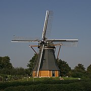 Borssele - De Hoop en Verwachting
 -
 't Hof te Baarland te Baarland
 -
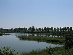 Wiel, showing a pool resulting from a dike breach and subsequent re-empoldering.


References[edit]
- ^ "Samenstelling College van B&W" [Members of the board of mayor and aldermen] (in Dutch). Gemeente Borsele. Archived from the original on 11 December 2013. Retrieved 6 December 2013.
- ^ "Kerncijfers wijken en buurten 2020" [Key figures for neighbourhoods 2020]. StatLine (in Dutch). CBS. 24 July 2020. Retrieved 19 September 2020.
- ^ "Postcodetool for 4441AT". Actueel Hoogtebestand Nederland (in Dutch). Het Waterschapshuis. Retrieved 6 December 2013.
- ^ "Bevolkingsontwikkeling; regio per maand" [Population growth; regions per month]. CBS Statline (in Dutch). CBS. 1 January 2021. Retrieved 2 January 2022.
External links[edit]
 Media related to Borsele at Wikimedia Commons
- Official website
Places adjacent to Borsele | |
|---|---|
Municipalities of Zeeland | ||
|---|---|---|
 | ||
| ||
| International | |
|---|---|
| National | |
| Geographic | |