Berryville, Arkansas | |
|---|---|
 Berryville Town Square (2006) | |
 Location of Berryville in Carroll County, Arkansas. | |
| Coordinates: 36°22′16″N 93°34′13″W / 36.37111°N 93.57028°W[1] | |
| Country | United States |
| State | Arkansas |
| County | Carroll |
| Founded | 1851 |
| Government | |
| • Mayor | Tim McKinney |
| Area | |
| • Total | 6.15 sq mi (15.93 km2) |
| • Land | 6.15 sq mi (15.93 km2) |
| • Water | 0.00 sq mi (0.00 km2) |
| Elevation | 1,243 ft (379 m) |
| Population (2020) | |
| • Total | 5,682 |
| • Density | 923.90/sq mi (356.70/km2) |
| Time zone | UTC-6 (CST) |
| • Summer (DST) | UTC-5 (CDT) |
| ZIP code | 72616 |
| Area code | 870, exchange 423,480 |
| FIPS code | 05-05560 |
| GNIS ID | 2403863[1] |
| Website | berryvillear.gov |
Berryville (/ˈbʌr.əˌvʊl/ BURR-ə-vul) is a city in Carroll County, Arkansas, United States. The population was 5,682 at the 2020 census.[3] making it the largest city in Carroll County. Along with Eureka Springs, it is one of the two county seats of Carroll County.[4]
History[edit]

Berryville was founded by local settler Blackburn Henderson Berry in 1850; his nephew James Henderson Berry would become the fourteenth governor of Arkansas in 1883.[5][6] The city was incorporated in 1876.[7]
Geography[edit]
U.S. Route 62 passes through the center of the city, leading east 30 miles (48 km) to Harrison and west 46 miles (74 km) to Rogers. Eureka Springs is 12 miles (19 km) to the west on US 62. Arkansas Highway 21 leads north from Berryville 16 miles (26 km) to the Missouri line.
According to the United States Census Bureau, Berryville has a total area of 6.1 square miles (15.8 km2), all land.[8]
Demographics[edit]
| Census | Pop. | Note | %± |
|---|---|---|---|
| 1880 | 253 | — | |
| 1890 | 549 | 117.0% | |
| 1900 | 551 | 0.4% | |
| 1910 | 785 | 42.5% | |
| 1920 | 1,474 | 87.8% | |
| 1930 | 1,286 | −12.8% | |
| 1940 | 1,482 | 15.2% | |
| 1950 | 1,753 | 18.3% | |
| 1960 | 1,999 | 14.0% | |
| 1970 | 2,271 | 13.6% | |
| 1980 | 2,966 | 30.6% | |
| 1990 | 3,212 | 8.3% | |
| 2000 | 4,433 | 38.0% | |
| 2010 | 5,356 | 20.8% | |
| 2020 | 5,682 | 6.1% | |
| U.S. Decennial Census[9] 2014 Estimate[10] | |||
2020 census[edit]
| Race | Number | Percentage |
|---|---|---|
| White (non-Hispanic) | 3,425 | 60.28% |
| Black or African American (non-Hispanic) | 15 | 0.26% |
| Native American | 43 | 0.76% |
| Asian | 118 | 2.08% |
| Pacific Islander | 257 | 4.52% |
| Other/Mixed | 282 | 4.96% |
| Hispanic or Latino | 1,542 | 27.14% |
As of the 2020 United States census, there were 5,682 people, 2,009 households, and 1,269 families residing in the city.
2010 census[edit]
As of the census[12] of 2010, there were 5,356 people, 1,963 households, and 1,309 families residing in the city. The population density was 879.0 inhabitants per square mile (339.4/km2). There were 2,155 housing units at an average density of 353.3 per square mile (136.4/km2). The racial makeup of the city was 81.7% White, 0.5% Black or African American, 0.8% Native American, 0.9% Asian, 0.4% Native Hawaiian or Pacific Islander, 13.2% some other race, and 2.6% two or more races. 24.7% of the population were Hispanic or Latino of any race.[13]
There were 1,963 households, out of which 38.9% had children under the age of 18 living with them, 45.3% were headed by married couples living together, 14.9% had a female householder with no husband present, and 33.3% were non-families. 28.5% of all households were made up of individuals, and 13.3% were someone living alone who was 65 years of age or older. The average household size was 2.65, and the average family size was 3.26.[13]
In the city, the population was spread out, with 29.0% under the age of 18, 9.8% from 18 to 24, 25.5% from 25 to 44, 21.1% from 45 to 64, and 14.6% who were 65 years of age or older. The median age was 33.5 years. For every 100 females, there were 90.3 males. For every 100 females age 18 and over, there were 86.0 males.[13]
For the period 2008–2012, the estimated median annual income for a household in the city was $30,046, and the median income for a family was $37,717. Male full-time workers had a median income of $28,244 versus $24,074 for females. The per capita income for the city was $16,924. About 14.2% of families and 17.4% of the population were below the poverty line, including 17.5% of those under age 18 and 14.8% of those age 65 or over.[14]
Education[edit]
Public education for elementary and secondary school students is provided by the Berryville School District, which leads to graduation at Berryville High School.
Places of interest[edit]

Saunders' Museum, which has guns used by outlaws such as Pancho Villa, Billy the Kid, and many others, as well as other items of interest, is located in the center of town.
Cosmic Cavern is 7 miles (11 km) north of town on Arkansas Highway 21.
Berryville is the home of handgun manufacturing companies of Nighthawk Custom and Wilson Combat, as well as the International Defensive Pistol Association, a body that sanctions practical shooting competitions that emphasize real-world self-defense scenarios.
Little Portion Hermitage, a community founded by Christian musician John Michael Talbot, is located outside of Berryville.
Transportation[edit]
Roadways[edit]
 US Highway 62
 US Highway 62 Spur
 Arkansas Highway 21
 Arkansas Highway 143
 Arkansas Highway 221
 Arkansas Highway 980
Transit[edit]
Notable people[edit]
- Bob Ballinger, Republican member of the Arkansas House of Representatives from District 97 (Carroll, Madison, and Washington counties); resides and maintains law office in Berryville[15]
- James Henderson Berry, U.S. senator, 14th governor of Arkansas
- Bradely Bunch, state senator in 1885
- James William Trimble, former congressman, unseated in 1966 by Republican John Paul Hammerschmidt, a former Berryville lawyer
- Bill Wilson, founder of US firearms manufacturer Wilson Combat
References[edit]
- ^ a b c U.S. Geological Survey Geographic Names Information System: Berryville, Arkansas
- ^ "2020 U.S. Gazetteer Files". United States Census Bureau. Retrieved October 29, 2021.
- ^ "Explore Census Data". data.census.gov. Retrieved December 3, 2021.
- ^ "Find a County". National Association of Counties. Archived from the original on May 31, 2011. Retrieved June 7, 2011.
- ^ The Encyclopedia of Arkansas History & Culture: Berryville (Carroll County). September 23, 2009. Retrieved 2009-11-11.
- ^ "Profile for Berryville, Arkansas, AR". ePodunk. Retrieved August 17, 2012.
- ^ History of Benton, Washington, Carroll, Madison, Crawford, Franklin, and Sebastian Counties, Arkansas. Higginson Book Company. 1889. p. 390.
- ^ "Geographic Identifiers: 2010 Demographic Profile Data (G001): Berryville city, Arkansas". U.S. Census Bureau, American Factfinder. Archived from the original on February 12, 2020. Retrieved June 13, 2014.
- ^ "Census of Population and Housing". Census.gov. Retrieved June 4, 2015.
- ^ "Annual Estimates of the Resident Population for Incorporated Places: April 1, 2010 to July 1, 2014". Archived from the original on May 22, 2015. Retrieved June 4, 2015.
- ^ "Explore Census Data". data.census.gov. Retrieved January 1, 2022.
- ^ "U.S. Census website". United States Census Bureau. Retrieved January 31, 2008.
- ^ a b c "Profile of General Population and Housing Characteristics: 2010 Demographic Profile Data (DP-1): Berryville city, Arkansas". U.S. Census Bureau, American Factfinder. Archived from the original on February 12, 2020. Retrieved June 13, 2014.
- ^ "Selected Economic Characteristics: 2008-2012 American Community Survey 5-Year Estimates (DP03): Berryville city, Arkansas". U.S. Census Bureau, American Factfinder. Archived from the original on February 12, 2020. Retrieved June 13, 2014.
- ^ "Bob Ballinger, R-97". arkansashouse.org. Archived from the original on January 8, 2014. Retrieved January 7, 2014.
External links[edit]
- City of Berryville official website Archived October 19, 2012, at the Wayback Machine
Municipalities and communities of Carroll County, Arkansas, United States | ||
|---|---|---|
| Cities | 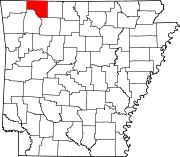 | |
| Towns | ||
| Townships | ||
| Unincorporated communities | ||
| Ghost towns | ||
| Footnotes | ‡This populated place also has portions in an adjacent county or counties | |
| International | |
|---|---|
| National | |
| Other | |