Barceloneta
Municipio Autónomo de Barceloneta | |
|---|---|
Town and Municipality | |
 Barceloneta in letters sculpture | |
 Flag  Coat of arms | |
| Nicknames: "La Ciudad de las Piñas", "La Ciudad Industrial," "El Pueblo de los Indios", "El Pueblo de Sixto Escobar" | |
| Anthem: "Querido Barceloneta" | |
 Map of Puerto Rico highlighting Barceloneta Municipality | |
| Coordinates: 18°27′02″N 66°32′19″W / 18.45056°N 66.53861°W | |
| Sovereign state | |
| Commonwealth | |
| Founded | July 1, 1881 |
| Barrios | |
| Government | |
| • Mayor | Wanda Soler (PPD) |
| • Senatorial dist. | 3 - Arecibo |
| • Representative dist. | 13 |
| Area | |
| • Total | 36.39 sq mi (94.24 km2) |
| • Land | 32 sq mi (82 km2) |
| • Water | 4.73 sq mi (12.24 km2) |
| Population (2020)[1] | |
| • Total | 22,657 |
| • Rank | 56th in Puerto Rico |
| • Density | 620/sq mi (240/km2) |
| Demonym | Barcelonetences |
| Time zone | UTC−4 (AST) |
| ZIP Code | 00617 |
| Area code | 787/939 |
| Major routes | |
Barceloneta (Spanish pronunciation: [baɾseloˈneta], locally [baɭseloˈneta]) is a town and municipality in Puerto Rico located in the north region, bordering the Atlantic Ocean, north of Florida (city and municipality in Puerto Rico), east of Arecibo, and west of Manatí. Barceloneta is spread over 3 barrios and Barceloneta Pueblo (the downtown area and the administrative center of the city). It is part of the San Juan-Caguas-Guaynabo Metropolitan Statistical Area.
Etymology[edit]
The name of Barceloneta ("Little Barcelona") is derived from the Spanish city, from where the town's founder originated. Barceloneta is also the name of a beach and neighborhood of Barcelona.[2]
History[edit]
Barceloneta was founded on July 1, 1881 by Bonocio Llenza Feliú,[3] an immigrant from Barcelona, Spain. Barceloneta was one of the last municipalities created by the Spanish Government in Puerto Rico.[2][4]

Puerto Rico was ceded by Spain in the aftermath of the Spanish–American War under the terms of the Treaty of Paris of 1898 and became a territory of the United States. In 1899, the United States conducted its first census of Puerto Rico finding that the population of Barceloneta was 9,357.
About a decade after its foundation, the town had a significant economic development led by agriculture and industry. By 1894, there were three sugarcane estates, 93 sugar mills, and the production of other fruits.[5] Because of its location next to the Río Grande de Manatí, Barceloneta was known for many years as a site of important port activity, for shipment of sugar and salt, as well as passengers to New York City and Barcelona. Bonocio's son was the owner of a sail ship that made those routes.[3]
In 1899, Barceloneta requested to be annexed to the town of Manatí. An election was scheduled for August 14, 1899 to decide the matter. However, on August 8, the island suffered the effects of Hurricane San Ciriaco, which prevented the elections from being held. The following year, Governor George Whitefield Davis ordered the annexation of Barceloneta into Manatí. The annexation was short-lived. Eleven years later, the government reinstated Barceloneta as a municipality.[6]
After Central Plazuela, a large sugar cane mill, closed in 1963, Barceloneta started reinforcing its agricultural economy with pineapples and other minor fruits. Efforts to revive the economy were not too successful, until pharmaceutical industries established themselves in the town during the 1970s.[7] For a time, Barceloneta supplied all of the Viagra for North America.[8]
Hurricane Maria struck Puerto Rico on September 20, 2017 causing large-scale damage and destruction to infrastructure.[9][10] In Barceloneta, some homes and establishments along the coast were flooded with up to 15 feet of water, and nearly all wooden homes were destroyed.[11]
Geography[edit]
The Municipality of Barceloneta sits on the Northern Karst region of Puerto Rico, on the shores of the Atlantic Ocean. It is bordered by the municipalities of Arecibo, Florida, and Manatí. In terms of physical features, the municipality occupies a roughly rectangular area in the northern coast of the island. It has a surface area of 36.4 square miles (94.24 km2).[7]
Barceloneta's terrain is predominantly plain. Since it is located in the karst region, it features hills, ponors, and caves. Near the coast, the terrain is occupied by the Caño Tiburones wetlands.[12]
Updated flood zone maps (as of 2019) show that Barceloneta is extremely vulnerable to flooding, along with Humacao, Rincón, Toa Baja, and Corozal. For its many wetlands, Barceloneta ends up being extremely vulnerable when hit by a major hurricane.[13]
Water features[edit]
The Río Grande de Manatí travels across the municipalities of Manatí and Barceloneta and drains into the Atlantic Ocean. Barceloneta also features the Caño Tiburones, a natural reserve.[7][12][14]
Barrios[edit]

Like all municipalities of Puerto Rico, Barceloneta is subdivided into barrios. The municipal buildings, central square and large Catholic church are located in a small barrio referred to as "el pueblo", near the center of the municipality.[15][16][17]
Sectors[edit]
Barrios (which are, in contemporary times, roughly comparable to minor civil divisions)[18] and subbarrios,[19] are further subdivided into smaller areas called sectores (sectors in English). The types of sectores may vary, from normally sector to urbanización to reparto to barriada to residencial, among others.[20][21][22]
Special Communities[edit]
Comunidades Especiales de Puerto Rico (Special Communities of Puerto Rico) are marginalized communities whose citizens are experiencing a certain amount of social exclusion. A map shows these communities occur in nearly every municipality of the commonwealth. Of the 742 places that were on the list in 2014, the following barrios, communities, sectors, or neighborhoods were in Barceloneta: Abra del Pimiento, Abra los Caballos, Cité Sector in Garrochales, Palenque, and Seboruco.[23]
Tourism[edit]

Landmarks and places of interest[edit]
There are six beaches in Barceloneta including a black sand beach called Machuca.[24]
Barceloneta has many places of interest.[25]
- Antiguo Muelle (the old seaport)
- Cambalache Forest Reserve
- Caño Tiburones marshland
- La Monserrate Refinery Ruins
- Las Criollas Beach
- Marqués de la Esperanza Hacienda Ruins
- Palmas Altas Beach
- Sixto Escobar Museum
- Centro Cultural de Barceloneta: Located in the heart of the city, the museum is dedicated to the culture and history of Barceloneta. Also features a collection of archaeological artifacts and Taino pieces.
To stimulate local tourism during the COVID-19 pandemic in Puerto Rico, the Puerto Rico Tourism Company launched the Voy Turistiendo (I'm Touring) campaign in 2021. The campaign featured a passport book with a page for each municipality. The Voy Turisteando Barceloneta passport page lists Malecón de la Boca, Antiguo Hospital Bonocio Llenza Feliú, La Mirada del Taíno, Semilla (for agritourism), and Playa Arena Negra, as places of interest.[26]
Culture[edit]
Sports[edit]
Festivals[edit]
Barceloneta celebrates its patron saint festival in mid-July, generally from Wednesday to Sunday. The Fiestas Patronales de la Virgen del Carmen is a religious and cultural celebration that generally features parades, games, artisans, amusement rides, regional food, and live entertainment.[25] The festival has featured live performances by well-known artists such as Odilio González, La Sonora Ponceña, Pedro Capó, Andrés Jiménez, José Alberto "El Canario" and Tito Nieves.[27]
Economy[edit]
Barceloneta has the biggest pharmaceutical complex in the world (14 industries). These companies have chosen Barceloneta to establish their facilities for its underground water reservoirs. The water in Barceloneta requires very little treatment for use in the manufacturing of pharmaceutical products.[7]
The employment created by these companies, along with a well-developed plan for urban growth, has allowed Barceloneta to be more than simply a town where people go to work. Puerto Rico Premium Outlets, near the expressway, have made the town into a destination for shopping and consumerism and consequently a place for investment in food chains and entertainment. Increased employment opportunities have also caused an increase in population in Barceloneta and its surrounding municipalities.
Barceloneta is also known for its black sand beaches.[28]
Demographics[edit]
| Census | Pop. | Note | %± |
|---|---|---|---|
| 1900 | 9,357 | — | |
| 1910 | 11,644 | 24.4% | |
| 1920 | 13,442 | 15.4% | |
| 1930 | 15,751 | 17.2% | |
| 1940 | 18,545 | 17.7% | |
| 1950 | 19,897 | 7.3% | |
| 1960 | 19,334 | −2.8% | |
| 1970 | 20,792 | 7.5% | |
| 1980 | 18,942 | −8.9% | |
| 1990 | 20,947 | 10.6% | |
| 2000 | 22,322 | 6.6% | |
| 2010 | 24,816 | 11.2% | |
| 2020 | 22,657 | −8.7% | |
| U.S. Decennial Census[29] 1899 (shown as 1900)[30] 1910-1930[31] 1930-1950[32] 1960-2000[33] 2010[16] 2020[34] | |||
Government[edit]
Barceloneta is known for its political stability. Mayor Sol Luis Fontanes held the mayor's seat for the Popular Democratic Party (PPD) from 1986 until 2012. He assumed the role after the sudden death of elected mayor Héctor Ruíz Martínez, also of the PPD. After that, Fontánes was elected by only a narrow margin (49.2% vs. 48.6%), but he gained popularity with time. At the 2008 general elections, Fontánes received more than 70% of the votes and his margin of victory was one of the biggest of that election.[36][37] However, on 2012, Fontánes was arrested on charges of extortion, after 24 years as mayor. He resigned on March 1, 2012 while in prison.[38] In 2012, Wanda Soler was elected as Fontánes replacement.[25] She was reelected in 2020 for her third term with 75% of the vote.[39][40]
The city belongs to the Puerto Rico Senatorial district III, which is represented by two senators. In 2008, José Emilio González and Angel Martínez were elected as district senators.[41]
Names and symbols[edit]
The municipio has an official flag and coat of arms.[42]
Flag[edit]
The flag of Barceloneta is a variation of the flag of Barcelona in Spain, from where the town borrows its name. It features four fields, two of them bearing the cross of Saint George (in Catalan, Sant Jordi), with five red and yellow bars in vertical direction to the right of each cross. These are all symbols pertaining to the city of Barcelona, and the community of Catalonia, where it is located, since the town was founded by a Catalan immigrant. The remaining two fields in the flag are blue, representing the Atlantic Ocean, which lies to the north of Barceloneta.[2][12][43][44]
Coat of arms[edit]
Barceloneta's coat of arms is similar to the flag, since it features the same Catalan symbols. However, it features three sugarcane flowers (guajanas) on top of the blue fields. The sugarcane flowers symbolize the source of life of the old agricultural economy of Barceloneta. The blue symbolizes the beaches and marine ports that contributed to the industry and commerce of the town. Like many coat of arms, it features a crown with three towers.[2]
Nicknames[edit]
Barceloneta is referred to as "La Ciudad de las Piñas" (Pineapple City) for its many pineapple plantations. It is also known as "La Ciudad Industrial" (Industrial City) for its many industries, mainly pharmaceutical.[45]
Other names are "Ciudad de los Indios" (City of the Indians) and "Pueblo de Sixto Escobar" (Town of Sixto Escobar) for being the birthplace of the Puerto Rican boxer.[citation needed]
Education[edit]
Transportation[edit]
Barceloneta has recently added the use of trolley cars, free of charge, for local transport within the town itself. For travel outside Barceloneta, there is a station for carros publicos (public car transportation), which is a type of taxi.
There are 9 bridges in Barceloneta.[46]
Gallery[edit]
Places in Barceloneta:
-
 The coast
 -
 City Hall in Barceloneta barrio-pueblo
 -
 Statue of Sixto Escobar
 -
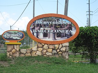 Welcome to Barceloneta sign
 -
 Thank you for visiting message on rock wall
 -
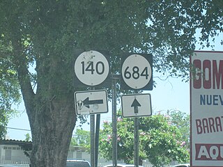 Signs for PR-140 and PR-684


See also[edit]
References[edit]
- ^ Bureau, US Census. "PUERTO RICO: 2020 Census". The United States Census Bureau. Retrieved August 25, 2021.
- ^ a b c d "Barceloneta Municipality Founding History and Symbols". enciclopediapr.org. Fundación Puertorriqueña de las Humanidades (FPH). Archived from the original on February 14, 2019. Retrieved February 14, 2019.
- ^ a b "Bonocio Llenza Feliú". El Portal Educativo de América. Retrieved November 14, 2022.
- ^ "Barceloneta, Puerto Rico". Areciboweb.50megs.com. Archived from the original on October 20, 2011. Retrieved February 18, 2012.
- ^ Barceloneta, Puerto Rico Archived 2012-03-25 at the Wayback Machine on BoricuaOnline
- ^ Barceloneta, municipio de Puerto Rico Archived 2011-11-29 at the Wayback Machine on PRfogui
- ^ a b c d "Barceloneta Municipality General Info (Location, Square Miles, Economy and Geography)". enciclopediapr. Fundación Puertorriqueña de las Humanidades (FPH). Archived from the original on February 14, 2019. Retrieved February 14, 2019.
- ^ Petra Bartosiewicz. "Before the Deluge / How Washington sealed Puerto Rico's fate". Harper's.
- ^ "Preliminary Locations of Landslide Impacts from Hurricane Maria, Puerto Rico". USGS Landslide Hazards Program. USGS. Archived from the original on March 3, 2019. Retrieved March 3, 2019.
- ^ "Preliminary Locations of Landslide Impacts from Hurricane Maria, Puerto Rico" (PDF). USGS Landslide Hazards Program. USGS. Archived (PDF) from the original on March 3, 2019. Retrieved March 3, 2019.
- ^ "María, un nombre que no vamos a olvidar. Sin respiro ni alivio en Barceloneta" [Maria, a name we will never forget. Without respite or relief in Barceloneta]. El Nuevo Día (in Spanish). June 13, 2019. Retrieved August 24, 2021.
- ^ a b c Barceloneta, Puerto Rico Archived 2012-03-25 at the Wayback Machine on BoricuaOnline.com
- ^ Alvarado León, Gerardo E. "Sobre 250,000 estructuras están en zonas inundables" (PDF). Junta de Planificación - Gobierno de Puerto Rico (in Spanish). El Nuevo Día. Archived (PDF) from the original on June 13, 2019. Retrieved July 3, 2019.
- ^ "Cinco datos curiosos sobre el caño Tiburones". El Nuevo Dia (in Spanish). April 10, 2014. Archived from the original on May 12, 2019. Retrieved May 12, 2019.
- ^ Gwillim Law (May 20, 2015). Administrative Subdivisions of Countries: A Comprehensive World Reference, 1900 through 1998. McFarland. p. 300. ISBN 978-1-4766-0447-3. Retrieved December 25, 2018.
- ^ a b Puerto Rico:2010:population and housing unit counts.pdf (PDF). U.S. Dept. of Commerce, Economics and Statistics Administration, U.S. Census Bureau. 2010. Archived (PDF) from the original on February 20, 2017. Retrieved December 28, 2018.
- ^ "Map of Barceloneta" (PDF). Archived (PDF) from the original on March 23, 2016. Retrieved December 17, 2007.
- ^ a b "US Census Barrio-Pueblo definition". factfinder.com. US Census. Archived from the original on May 13, 2017. Retrieved January 5, 2019.
- ^ "P.L. 94-171 VTD/SLD Reference Map (2010 Census): Barceloneta Municipio, PR" (PDF). www2.census.gov. U.S. DEPARTMENT OF COMMERCE Economics and Statistics Administration U.S. Census Bureau. Archived (PDF) from the original on August 22, 2020. Retrieved August 22, 2020.
- ^ "Agencia: Oficina del Coordinador General para el Financiamiento Socioeconómico y la Autogestión (Proposed 2016 Budget)". Puerto Rico Budgets (in Spanish). Archived from the original on June 28, 2019. Retrieved June 28, 2019.
- ^ Rivera Quintero, Marcia (2014), El vuelo de la esperanza: Proyecto de las Comunidades Especiales Puerto Rico, 1997-2004 (first ed.), San Juan, Puerto Rico Fundación Sila M. Calderón, ISBN 978-0-9820806-1-0
- ^ "Leyes del 2001". Lex Juris Puerto Rico (in Spanish). Archived from the original on September 14, 2018. Retrieved June 24, 2020.
- ^ Rivera Quintero, Marcia (2014), El vuelo de la esperanza:Proyecto de las Comunidades Especiales Puerto Rico, 1997-2004 (Primera edición ed.), San Juan, Puerto Rico Fundación Sila M. Calderón, p. 273, ISBN 978-0-9820806-1-0
- ^ "Las 1,200 playas de Puerto Rico [The 1200 beaches of Puerto Rico]". Primera Hora (in Spanish). April 14, 2017. Archived from the original on December 12, 2019. Retrieved December 12, 2019.
- ^ a b c "Barceloneta Municipality Festivals, Places, Mayor". enciclopediapr. Fundación Puertorriqueña de las Humanidades (FPH). Archived from the original on February 14, 2019. Retrieved February 14, 2019.
- ^ Pasaporte: Voy Turisteando (in Spanish). Compañia de Turismo de Puerto Rico. 2021.
- ^ "Fiestas de mi Pueblo Barceloneta, 2014". sondeaquiprnet. Barceloneta, Puerto Rico. Retrieved August 14, 2023.
- ^ Griffiths, Frank (September 5, 2004). "Puerto Rican Town Faces Economic Downturn". Washington Post. Retrieved February 27, 2024.
- ^ "U.S. Decennial Census". United States Census Bureau. Archived from the original on February 13, 2020. Retrieved September 21, 2017.
- ^ "Report of the Census of Porto Rico 1899". War Department Office Director Census of Porto Rico. Archived from the original on July 16, 2017. Retrieved September 21, 2017.
- ^ "Table 3-Population of Municipalities: 1930 1920 and 1910" (PDF). United States Census Bureau. Archived (PDF) from the original on August 17, 2017. Retrieved September 21, 2017.
- ^ "Table 4-Area and Population of Municipalities Urban and Rural: 1930 to 1950" (PDF). United States Census Bureau. Archived (PDF) from the original on August 30, 2015. Retrieved September 21, 2014.
- ^ "Table 2 Population and Housing Units: 1960 to 2000" (PDF). United States Census Bureau. Archived (PDF) from the original on July 24, 2017. Retrieved September 21, 2017.
- ^ Bureau, US Census. "PUERTO RICO: 2020 Census". The United States Census Bureau. Retrieved August 25, 2021.
- ^ "Population and Housing Unit Estimates". United States Census Bureau. Archived from the original on December 27, 1996. Retrieved September 21, 2017.
- ^ Carmen Milagros Díaz (January 15, 2012). "Hablan los alcaldes invencibles". El Vocero. Archived from the original on March 1, 2012.
- ^ "Elecciones en Puerto Rico". Electionspuertorico.org. Archived from the original on February 18, 2012. Retrieved February 18, 2012.
- ^ Caquías Cruz, Sandra (March 1, 2012). "Sol Luis Fontanes renuncia a la alcaldía de Barceloneta". El Nuevo Día. Archived from the original on March 4, 2012. Retrieved March 3, 2012.
- ^ "CEE Event". elecciones2020.ceepur.org. Retrieved June 17, 2021.
- ^ InterNewsService. "Alcaldesa de Barceloneta juramenta a su tercer término". El Vocero de Puerto Rico (in Spanish). Retrieved June 17, 2021.
- ^ Elecciones Generales 2008: Escrutinio General Archived November 20, 2011, at the Wayback Machine on CEEPUR
- ^ "Ley Núm. 70 de 2006 -Ley para disponer la oficialidad de la bandera y el escudo de los setenta y ocho (78) municipios". LexJuris de Puerto Rico (in Spanish). Retrieved June 15, 2021.
- ^ Barceloneta, municipio de Puerto Rico Archived 2011-11-29 at the Wayback Machine on PRfrogui
- ^ "BARCELONETA". LexJuris (Leyes y Jurisprudencia) de Puerto Rico (in Spanish). February 19, 2020. Archived from the original on February 19, 2020. Retrieved September 16, 2020.
- ^ "Barceloneta, Puerto Rico". Archived from the original on September 30, 2007. Retrieved August 28, 2006.
- ^ "Barceloneta Bridges". National Bridge Inventory Data. US Dept. of Transportation. Archived from the original on February 20, 2019. Retrieved February 19, 2019.
External links[edit]
Places adjacent to Barceloneta, Puerto Rico | ||||||||||||||||
|---|---|---|---|---|---|---|---|---|---|---|---|---|---|---|---|---|
| ||||||||||||||||
| International | |
|---|---|
| National | |
| Geographic | |